PhotoFeed Contest - Cityscape Photography Round 86
2 comments
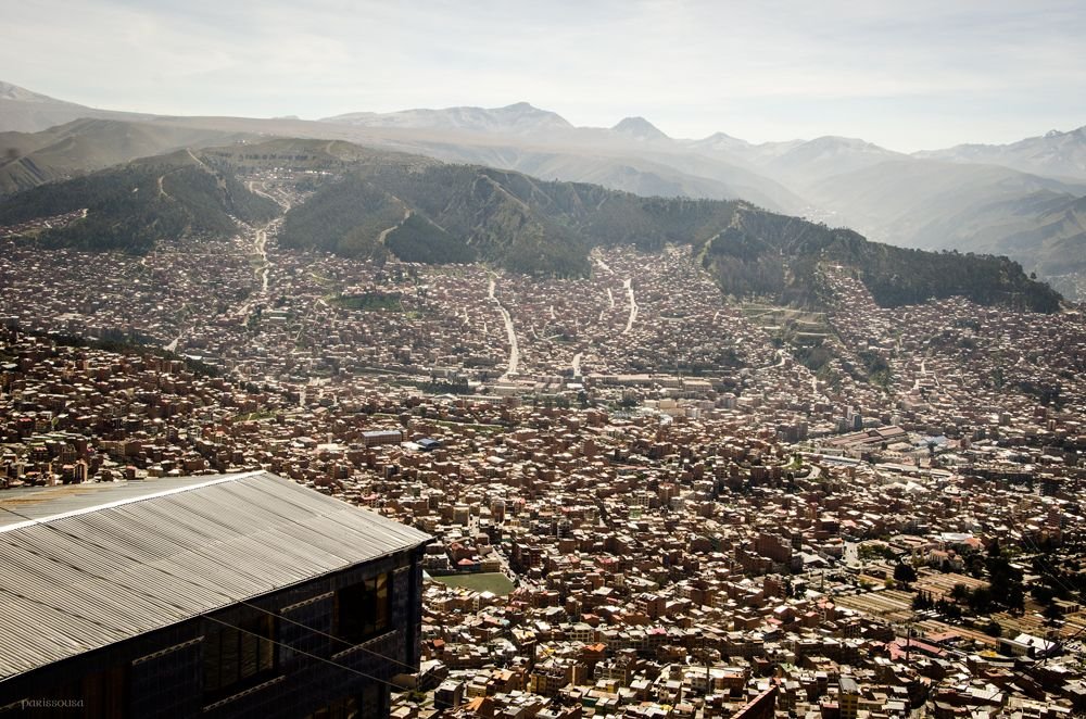
On my trip to La Paz, Bolivia, I traveled around the city using the cable car line. There are 11 cable car lines used for public transportation, and they are identified by color. The yellow line is the one that connects La Paz with the city of Alto. From there there is a viewing point that allowed me to take this panoramic photo of the city of La Paz.
En mi viaje por La Paz, Bolivia, recorrí la ciudad con la linea de teleféricos. Hay 11 líneas de teleféricos a modo de transporte público, y se las identifica por colores. La línea amarilla es la que une La Paz con la ciudad del Alto. Desde allí hay un mirador que me permitió tomar esta foto panorámica de la ciudad de La Paz.


Comments